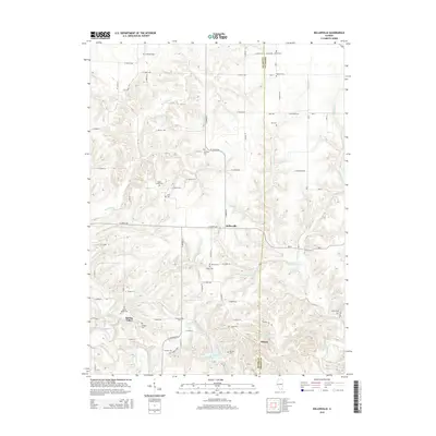
2015 Map of Kellerville
USGS Topo · Published 2015About this map
Siloam Springs State Park anchors the southeastern corner of this landscape, where the terrain breaks into the drainage of McKee Creek and Little Missouri Cr. The geography is defined by a dense network of family and community burial grounds, illustrating the deep-rooted settlement patterns of this rural borderland between Adams and Brown counties. Small clusters of habitation at Kellerville, Spring Valley, and Siloam are connected by a grid of section-line roads, such as N 1200th Ave.
Find a feature on this map
64 named features on this map. Tap any name to fly to it.
Don’t see what you’re looking for? This feature index may not catch every label — zoom into the map to look around manually.
Map Details
Editions of this 2015 Kellerville Map
This is the sole edition of this map. No revisions or reprints were ever made.
Other maps of this area

1925 · Liberty
USGS Topo · 1:62,500

1926 · Mt Sterling
USGS Topo · 1:62,500

1927 · Liberty
USGS Topo · 1:62,500

1929 · Mt Sterling
USGS Topo · 1:62,500

1946 · Augusta
USGS Topo · 1:62,500

1948 · Quincy
USGS Topo · 1:250,000

1948 · Camp Point
USGS Topo · 1:62,500

1949 · Augusta
USGS Topo · 1:62,500

1956 · Quincy
USGS Topo · 1:250,000

1958 · Burlington
USGS Topo · 1:250,000