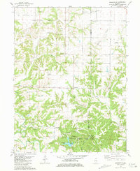
1981 Map of Kellerville
USGS Topo · Published 1981About this map
Siloam Springs State Park anchors the southern portion of this landscape, marking a transition from the agricultural uplands of Concord and Lee townships to the deeply incised drainage of the Mc Kee Creek basin. This area is notably dense with family and community burial grounds, preserving names such as Jefferson Cem, Dunkard Cem, and Ausmus Cem across the rolling terrain. The village of Kellerville sits at a central crossroads, while the historic Siloam (Site) is located within the state park boundary.
Find a feature on this map
43 named features on this map. Tap any name to fly to it.
Don’t see what you’re looking for? This feature index may not catch every label — zoom into the map to look around manually.
Map Details
Editions of this 1981 Kellerville Map
This is the sole edition of this map. No revisions or reprints were ever made.
Other maps of this area

1925 · Liberty
USGS Topo · 1:62,500

1926 · Mt Sterling
USGS Topo · 1:62,500

1927 · Liberty
USGS Topo · 1:62,500

1929 · Mt Sterling
USGS Topo · 1:62,500

1946 · Augusta
USGS Topo · 1:62,500

1948 · Quincy
USGS Topo · 1:250,000

1948 · Camp Point
USGS Topo · 1:62,500

1949 · Augusta
USGS Topo · 1:62,500

1956 · Quincy
USGS Topo · 1:250,000

1958 · Burlington
USGS Topo · 1:250,000