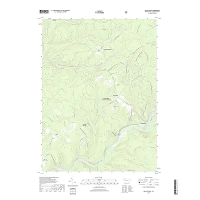
2019 Map of Kellettville
USGS Topo · Published 2019About this map
Kellettville and the winding course of Tionesta Creek anchor this survey of Forest County's heartland within the Allegheny National Forest. The landscape is defined by deep valleys and the remnants of early 20th-century transport, notably the Old Railroad Grade that skirts the hills near Crystal Springs. Small settlements and high-ground clearings like Whig Hill and Yellow Hammer reflect the region's scattered upland history, often centered around family or community burial grounds such as Whig Hill Cem and Kiffer Hill Cem.
Find a feature on this map
73 named features on this map. Tap any name to fly to it.
Don’t see what you’re looking for? This feature index may not catch every label — zoom into the map to look around manually.
Map Details
Editions of this 2019 Kellettville Map
This is the sole edition of this map. No revisions or reprints were ever made.
Other maps of this area

1918 · Loleta
USGS Topo · 1:62,500

1922 · Tionesta
USGS Topo · 1:62,500

1924 · Tionesta
USGS Topo · 1:62,500

1927 · Tidioute
USGS Topo · 1:48,000

1930 · Tidioute
USGS Topo · 1:62,500

1935 · Sheffield
USGS Topo · 1:48,000

1936 · Marienville
USGS Topo · 1:48,000

1941 · Sheffield
USGS Topo · 1:62,500

1941 · Marienville
USGS Topo · 1:62,500

1946 · Tionesta
USGS Topo · 1:62,500
Featured Places
- Starr, Kingsley Township
- Kingsley Township, PA
- Hickory Township, PA
- Green Township, PA
- Yellow Hammer, Hickory Township