2022 Map of Kellogg
USGS Topo · Published 2022About this map
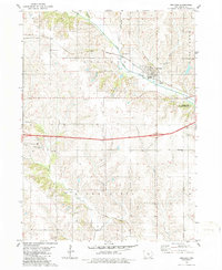
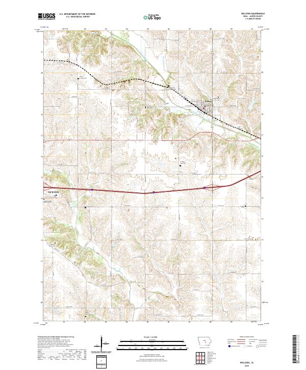
Kellogg serves as the focal point of this Jasper County landscape, situated along the North Skunk River as it flows toward the southeast. The area is defined by a dense network of country roads, following the section lines of the Public Land Survey System, including Image Ave and N 51st Ave E. This grid provides access to a significant concentration of family and community burial grounds, such as Center Friends Cem, Old German Lutheran Cem, and the Jasper County Burial Ground. The topography is shaped by several tributaries, including Burr Oak Cr, Slater Cr, and Coon Cr, which carve through the Iowa prairie. The map also captures the eastern edge of Newton, illustrating the transition from urban expansion to the sprawling agricultural tracts and small-town character that define this region.
Find a feature on this map
44 named features on this map. Tap any name to fly to it.
Don’t see what you’re looking for? This feature index may not catch every label — zoom into the map to look around manually.
Map Details
Editions of this 2022 Kellogg Map
This is the sole edition of this map. No revisions or reprints were ever made.