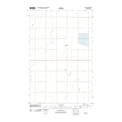
2011 Map of Kelly
USGS Topo · Published 2011About this map
Grand Forks International Airport dominates the central portion of this landscape, its runways and infrastructure situated amidst the flat agricultural plains of the Red River Valley. The terrain is defined by a series of meandering watercourses, most notably Salt Water Coulee and Fresh Water Coulee, which snake through the northwestern sections. To the south, English Coulee provides further drainage for the region's low-lying fields. Small crossroads communities like Kelly and Powell punctuate the grid of section lines and gravel roads, reflecting the traditional settlement patterns of Grand Forks County. This 2011 survey illustrates the coexistence of vital modern transportation hubs and established prairie farming tracts, with major thoroughfares such as Demers Ave providing essential east-west connectivity across the quadrangle.
Find a feature on this map
30 named features on this map. Tap any name to fly to it.
Don’t see what you’re looking for? This feature index may not catch every label — zoom into the map to look around manually.
Map Details
Editions of this 2011 Kelly Map
This is the sole edition of this map. No revisions or reprints were ever made.
Other maps of this area

1926 · Ardoch
USGS Topo · 1:62,500

1934 · Emerado
USGS Topo · 1:48,000

1934 · Grand Forks
USGS Topo · 1:24,000

1934 · Grand Forks
USGS Topo · 1:62,500

1936 · Emerado
USGS Topo · 1:62,500

1938 · Grand Forks
USGS Topo · 1:62,500

1952 · Grand Forks
USGS Topo · 1:250,000

1952 · Thief River Falls
USGS Topo · 1:250,000

1956 · Thief River Falls
USGS Topo · 1:250,000

1956 · Grand Forks
USGS Topo · 1:250,000