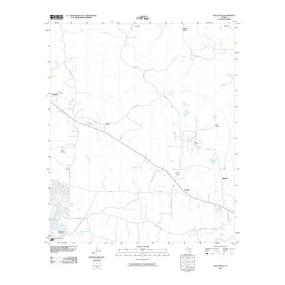
2010 Map of Kellyville
USGS Topo · Published 2010About this map
Black Cypress Bayou meanders through a landscape of piney woods and wetlands in this early 21st-century study of the area northwest of Jefferson. The map centers on the small community of Kellyville and the nearby Kellyville Siding, illustrating the intersection of the regional rail line with local roads like Kellyville Rd and Kellyville Cut-Off Rd. The southwestern corner is dominated by the reservoir waters of Lake O' the Pines, held back by the Ferrells Bridge Dam, which serves as a major geographical anchor for the region. Genealogists will find significant value in the scattered rural burial grounds, including Beamer-Davis Cemetery, Simmons Cemetery, and Webb Cemetery. Small settlements like Berea, Lassater, and Sarber are depicted alongside local landmarks such as Sarber Lake and the East Abutment Recreation Area.
Find a feature on this map
44 named features on this map. Tap any name to fly to it.
Don’t see what you’re looking for? This feature index may not catch every label — zoom into the map to look around manually.
Map Details
Editions of this 2010 Kellyville Map
This is the sole edition of this map. No revisions or reprints were ever made.
Other maps of this area

1956 · Tyler
USGS Topo · 1:250,000

1961 · Cunningham Creek
USGS Topo · 1:24,000

1961 · Lassater
USGS Topo · 1:24,000

1961 · Harleton
USGS Topo · 1:24,000

1962 · Kellyville
USGS Topo · 1:24,000

1962 · Lanier
USGS Topo · 1:24,000

1962 · Marshall NW
USGS Topo · 1:24,000

1962 · Woodlawn
USGS Topo · 1:24,000

1962 · Jefferson
USGS Topo · 1:24,000

1962 · Avinger
USGS Topo · 1:24,000