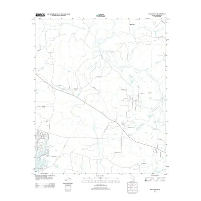
2013 Map of Kellyville
USGS Topo · Published 2013About this map
Kellyville and its surrounding wetlands anchor this landscape where the Black Cypress Bayou and Big Cypress Bayou meander through East Texas. The infrastructure reflects a blend of rural settlement and recreational development, seen in the residential clusters near Lake o' the Pines and the East Abutment Recreation Area. Smaller communities like Berea, Sarber, and White Oak are connected by a network of farm-to-market roads and local routes like Old Miller Rd. Transportation history is visible at Kellyville Siding, while family lineage is preserved at Valley Plains Cem, Beamer Davis Cem, and Webb Cem. The complex hydrology of Cattail Cr and Hurricane Cr defines the low-lying terrain, creating a distinct environmental profile between the larger bayou systems.
Find a feature on this map
67 named features on this map. Tap any name to fly to it.
Don’t see what you’re looking for? This feature index may not catch every label — zoom into the map to look around manually.
Map Details
Editions of this 2013 Kellyville Map
This is the sole edition of this map. No revisions or reprints were ever made.
Other maps of this area

1956 · Tyler
USGS Topo · 1:250,000

1961 · Cunningham Creek
USGS Topo · 1:24,000

1961 · Lassater
USGS Topo · 1:24,000

1961 · Harleton
USGS Topo · 1:24,000

1962 · Kellyville
USGS Topo · 1:24,000

1962 · Lanier
USGS Topo · 1:24,000

1962 · Marshall NW
USGS Topo · 1:24,000

1962 · Woodlawn
USGS Topo · 1:24,000

1962 · Jefferson
USGS Topo · 1:24,000

1962 · Avinger
USGS Topo · 1:24,000