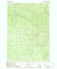
1988 Map of Kelsay Butte
USGS Topo · Published 1988About this map
The North Fork John Day River carves a deep path through this portion of the Umatilla National Forest, serving as a central artery for the region's wilderness character in the late 1980s. The landscape is defined by its high-elevation meadows and springs, including Kelsay Meadows, Lost Horse Meadow, and the vital water source at Kelsay Spring. Human activity is primarily centered on seasonal recreation and resource extraction, evidenced by several established campsites like Oriental Creek Campground and Battle Creek Camp, alongside industrial markers such as the Welch Creek Mine and a local Quarry. The map provides a detailed view of the North Fork John Day Wilderness boundary, where numerous creeks including Bismark Creek and Simpson Creek drain into the main river fork.
Find a feature on this map
38 named features on this map. Tap any name to fly to it.
Don’t see what you’re looking for? This feature index may not catch every label — zoom into the map to look around manually.
Map Details
Editions of this 1988 Kelsay Butte Map
This is the sole edition of this map. No revisions or reprints were ever made.
Other maps of this area

1951 · Dale
USGS Topo · 1:62,500

1951 · Desolation Butte
USGS Topo · 1:62,500

1953 · Pendleton
USGS Topo · 1:250,000

1955 · Canyon City
USGS Topo · 1:250,000

1956 · Pendleton
USGS Topo · 1:250,000

1959 · Canyon City
USGS Topo · 1:250,000

1967 · Ukiah SE
USGS Topo · 1:24,000

1967 · Tower Mtn
USGS Topo · 1:24,000

1967 · Pearson Ridge
USGS Topo · 1:24,000
1979 · La Grande
USGS Topo · 1:100,000