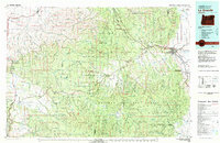
1979 Map of La Grande
USGS Topo · Published 1980About this map
The Grande Ronde River and the Union Pacific Railroad define the industrial and transit corridor through the Blue Mountains in this late 1970s topographic record. La Grande serves as the regional hub, flanked by smaller communities like Island City and the mountain settlement of Starkey. Much of the terrain is governed by the Umatilla National Forest and Whitman National Forest, reflecting a landscape managed for timber, wildlife, and research, most notably within the Starkey Experimental Forest. Evidence of the region's pioneering history is preserved in the Old Emigrant Road, while the resource extraction economy is marked by sites like the Aurelia Mine and Camp Carson Mine. This map captures the transition from historic trails to modern infrastructure, including Interstate 80N, against a backdrop of complex drainage systems including Meadow Creek and Catherine Creek.
Find a feature on this map
84 named features on this map. Tap any name to fly to it.
Don’t see what you’re looking for? This feature index may not catch every label — zoom into the map to look around manually.
Map Details
Editions of this 1979 La Grande Map
2 editions found
Other maps of this area

1901 · Baker City
USGS Topo · 1:125,000

1901 · Sumpter
USGS Topo · 1:125,000

1906 · Telocaset
USGS Topo · 1:125,000

1908 · Umatilla
USGS Topo · 1:125,000

1935 · Pendleton
USGS Topo · 1:125,000

1950 · Ritter
USGS Topo · 1:62,500

1951 · Dale
USGS Topo · 1:62,500

1951 · Desolation Butte
USGS Topo · 1:62,500

1952 · Ritter
USGS Topo · 1:62,500

1953 · Pendleton
USGS Topo · 1:250,000