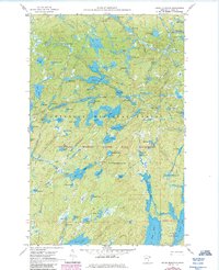
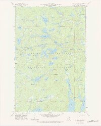
1960 Map of Kelso Mountain
USGS Topo · Published 1986About this map
Kelso Mountain rises as a central landmark in this 1960s study of the Minnesota Arrowhead region, an area defined by its complex glacial hydrology. The landscape is dominated by a dense network of interconnected waterways, from Fente Lake in the north to the larger expanse of Mesaba Lake. This era represents a significant period in the conservation history of the north woods, as the map prominently delineates the Superior National Forest and the Boundary Waters Canoe Area Wilderness.
Find a feature on this map
78 named features on this map. Tap any name to fly to it.
Don’t see what you’re looking for? This feature index may not catch every label — zoom into the map to look around manually.
Map Details
Editions of this 1960 Kelso Mountain Map
5 editions found
Other maps of this area

1954 · Two Harbors
USGS Topo · 1:250,000

1957 · Two Harbors
USGS Topo · 1:250,000

1957 · Quetico
USGS Topo · 1:250,000

1958 · Two Harbors
USGS Topo · 1:250,000

1959 · Ogishkemuncie Lake
USGS Topo · 1:24,000

1959 · Gillis Lake
USGS Topo · 1:24,000

1960 · Lake Polly
USGS Topo · 1:24,000

1960 · Kawishiwi Lake
USGS Topo · 1:24,000

1960 · Sawbill Camp
USGS Topo · 1:24,000

1960 · Beth Lake
USGS Topo · 1:24,000