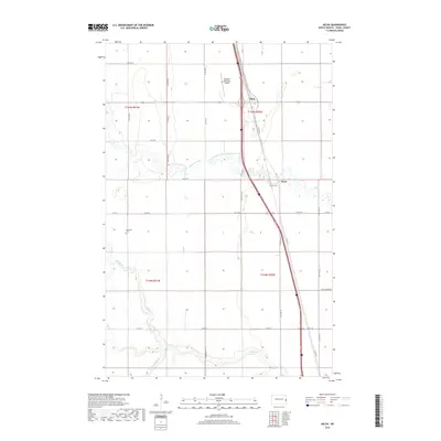
2018 Map of Kelso
USGS Topo · Published 2018About this map
The Elm River and its meandering tributaries, the N Br Elm River and S Br Elm River, define the agricultural landscape of this portion of Traill County. Settlement is concentrated along the corridor of Co Hwy 81, where the small communities of Kelso and Alton serve as local landmarks. The presence of the Kelso Floodway indicates the region's managed relationship with the seasonal water flow of the Red River Valley plains. This 2018 survey also records vital infrastructure including the Hillsboro Municipal Airport and the Bohnsack Cem, providing essential points of reference for local historians and genealogists tracking family ties to these prairie settlements. The grid of section lines and county roads, such as Co Rd 3 and Co Hwy 1, underscores the orderly distribution of land typical of North Dakota's farming heartland.
Find a feature on this map
30 named features on this map. Tap any name to fly to it.
Don’t see what you’re looking for? This feature index may not catch every label — zoom into the map to look around manually.
Map Details
Editions of this 2018 Kelso Map
This is the sole edition of this map. No revisions or reprints were ever made.
Other maps of this area

1918 · Kelso
USGS Topo · 1:62,500

1918 · Hendrum
USGS Topo · 1:62,500

1943 · Kelso
USGS Topo · 1:62,500

1952 · Grand Forks
USGS Topo · 1:250,000

1956 · Grand Forks
USGS Topo · 1:250,000

1963 · Gardner
USGS Topo · 1:24,000

1963 · Hillsboro
USGS Topo · 1:24,000

1963 · Kelso
USGS Topo · 1:24,000

1963 · Halstad SW
USGS Topo · 1:24,000
1964 · Caledonia
USGS Topo · 1:24,000