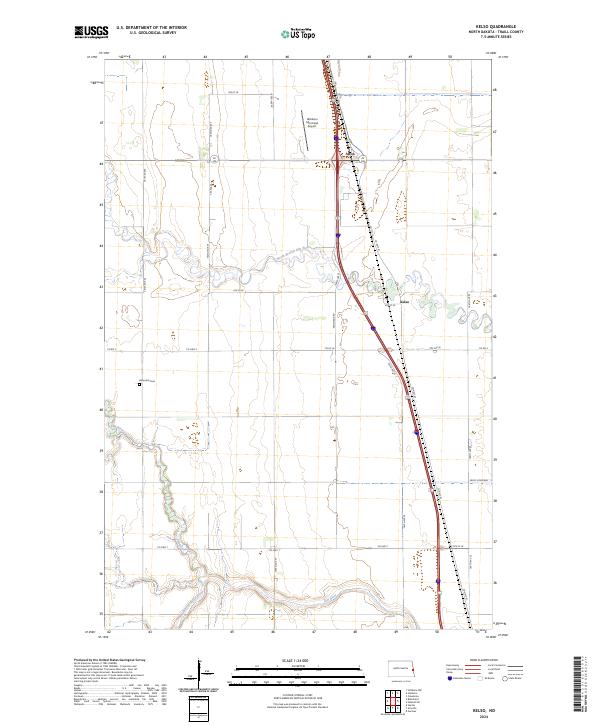
2024 Map of Kelso
USGS Topo · Published 2024About this map
Elm River and its various branches, including the North Branch Elm River and South Branch Elm River, define the rural landscape of Traill County in this 2024 survey. The topography is dominated by the sprawling agricultural grid, interrupted only by the critical water management of the Kelso Floodway and the meandering river paths. Small settlements like Kelso and Alton serve as local hubs along the transportation corridor of County Highway 81, while the Hillsboro Municipal Airport stands as a modern landmark in the northern portion of the quadrangle. For those researching local family history, the Bohnsack Cem is a notable landmark situated west of the river. The map illustrates a contemporary view of North Dakota's eastern plains, where traditional farming layouts coexist with essential infrastructure and flood control systems.
Find a feature on this map
28 named features on this map. Tap any name to fly to it.
Don’t see what you’re looking for? This feature index may not catch every label — zoom into the map to look around manually.
Map Details
Editions of this 2024 Kelso Map
This is the sole edition of this map. No revisions or reprints were ever made.
Other maps of this area

1918 · Kelso
USGS Topo · 1:62,500

1918 · Hendrum
USGS Topo · 1:62,500

1943 · Kelso
USGS Topo · 1:62,500

1952 · Grand Forks
USGS Topo · 1:250,000

1956 · Grand Forks
USGS Topo · 1:250,000

1963 · Gardner
USGS Topo · 1:24,000

1963 · Hillsboro
USGS Topo · 1:24,000

1963 · Kelso
USGS Topo · 1:24,000

1963 · Halstad SW
USGS Topo · 1:24,000
1964 · Caledonia
USGS Topo · 1:24,000