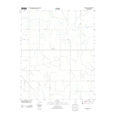
2012 Map of Kelton NW
USGS Topo · Published 2012About this map
Wheeler Municipal Airport sits at the center of this high plains landscape in Wheeler County, serving as a modern landmark in a region defined by its seasonal drainage systems. The terrain is intricately etched by numerous waterways, most notably the winding course of Sweetwater Cr which traverses the northern half of the map. Smaller tributaries such as Silver Cr, Goodin Cr, and Coburn Cr feed into this system, illustrating the natural drainage patterns of the Texas Panhandle. The map reveals a strictly organized grid of rural infrastructure, where routes like Co Road J and Co RD-17 provide access to remote ranching and agricultural lands. To the south, the headwaters of E Br Bronco Cr emerge, showing how these intermittent streams shape the local topography. This 2012 survey captures the intersection of traditional land use and essential regional aviation, as seen with the proximity of FM-2697 and Ranch Road 1906 to the expansive airport grounds.
Find a feature on this map
20 named features on this map. Tap any name to fly to it.
Don’t see what you’re looking for? This feature index may not catch every label — zoom into the map to look around manually.
Map Details
Editions of this 2012 Kelton NW Map
This is the sole edition of this map. No revisions or reprints were ever made.
Other maps of this area

1954 · Amarillo
USGS Topo · 1:250,000

1958 · Amarillo
USGS Topo · 1:250,000

1962 · Twitty
USGS Topo · 1:24,000

1962 · Kelton SE
USGS Topo · 1:24,000

1962 · Wheeler
USGS Topo · 1:24,000

1962 · Wheeler SE
USGS Topo · 1:24,000

1963 · Allison
USGS Topo · 1:24,000

1963 · Kelton
USGS Topo · 1:24,000

1963 · Kelton NW
USGS Topo · 1:24,000

1963 · Briscoe
USGS Topo · 1:24,000