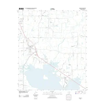
2012 Map of Kemp
USGS Topo · Published 2012About this map
The settlement of Kemp and its surrounding countryside in Kaufman County are defined by a complex network of waterways feeding into the massive Cedar Cr Reservoir. This early 21st-century landscape shows a blend of rural agriculture and energy production, most notably the Ham-Gossett Oil Field located east of the reservoir's north arm. The town of Kemp itself serves as a local hub, situated between Kemp Lake and the wetlands of Kings Cr.
Find a feature on this map
85 named features on this map. Tap any name to fly to it.
Don’t see what you’re looking for? This feature index may not catch every label — zoom into the map to look around manually.
Map Details
Editions of this 2012 Kemp Map
This is the sole edition of this map. No revisions or reprints were ever made.
Other maps of this area

1920 · Kemp
USGS Topo · 1:62,500

1954 · Dallas
USGS Topo · 1:250,000

1956 · Kaufman
USGS Topo · 1:62,500

1957 · Kemp
USGS Topo · 1:62,500

1958 · Dallas
USGS Topo · 1:250,000

1960 · Tool
USGS Topo · 1:24,000

1960 · Mabank
USGS Topo · 1:24,000

1960 · Grays Prairie
USGS Topo · 1:24,000

1961 · Kemp
USGS Topo · 1:24,000

1962 · Prairieville
USGS Topo · 1:24,000