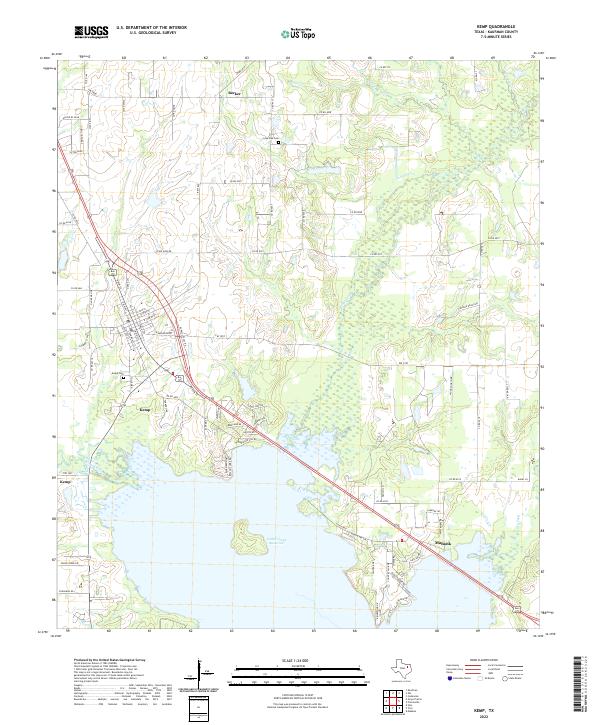
2022 Map of Kemp
USGS Topo · Published 2022About this map
The town of Kemp serves as the focal point for this Kaufman County survey, situated just north of the extensive Cedar Creek Reservoir. The settlement's grid, featuring streets like N Main St and S Commerce St, transitions into a landscape of winding creeks and rural road networks. To the southeast, the map captures the western edge of Mabank, connected to Kemp by a direct transit corridor crossing the upper reaches of the reservoir. The topography is defined by the convergence of several waterways, including Kings Creek, Walnut Cr, and Lacy Fork, which feed into the marshy northern inlets of the lake. Local genealogy is anchored by the Kemp Cem and Lone Oak Cem, while the small settlement of Becker marks the northern extent of the mapping area, providing a clear view of the region's development between established towns and modern reservoir infrastructure.
Find a feature on this map
82 named features on this map. Tap any name to fly to it.
Don’t see what you’re looking for? This feature index may not catch every label — zoom into the map to look around manually.
Map Details
Editions of this 2022 Kemp Map
This is the sole edition of this map. No revisions or reprints were ever made.
Other maps of this area

1920 · Kemp
USGS Topo · 1:62,500

1954 · Dallas
USGS Topo · 1:250,000

1956 · Kaufman
USGS Topo · 1:62,500

1957 · Kemp
USGS Topo · 1:62,500

1958 · Dallas
USGS Topo · 1:250,000

1960 · Tool
USGS Topo · 1:24,000

1960 · Mabank
USGS Topo · 1:24,000

1960 · Grays Prairie
USGS Topo · 1:24,000

1961 · Kemp
USGS Topo · 1:24,000

1962 · Prairieville
USGS Topo · 1:24,000