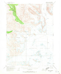
1951 Map of Kenai A-1
USGS Topo · Published 1972About this map
The vast glacial expanse of the Harding Ice Field dominates the southeastern portion of this 1950s survey, showing a landscape defined by moving ice and deep crevasses. These frozen heights feed a network of significant glaciers, including the Skilak Glacier to the north and the Tustumena Glacier at the southern margin. The terrain is part of the Kenai National Moose Range, where the high-altitude ice gives way to river systems like the Killey River, which flows out of Upper Killey Lake.
Find a feature on this map
13 named features on this map. Tap any name to fly to it.
Don’t see what you’re looking for? This feature index may not catch every label — zoom into the map to look around manually.
Map Details
Editions of this 1951 Kenai A-1 Map
3 editions found

Other maps of this area

1944 · Kenai
USGS Topo · 1:250,000

1946 · Blying Sound
USGS Topo · 1:250,000

1950 · Kenai
USGS Topo · 1:250,000

1950 · Kenai B-1
USGS Topo · 1:63,360

1950 · Seldovia D-2
USGS Topo · 1:63,360

1950 · Seward A-8
USGS Topo · 1:63,360

1951 · Blying Sound
USGS Topo · 1:250,000

1951 · Seward
USGS Topo · 1:250,000

1951 · Seldovia
USGS Topo · 1:250,000

1951 · Kenai B-2
USGS Topo · 1:63,360