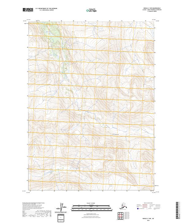
2024 Map of Kenai A-1 NW
USGS Topo · Published 2024About this map
Kenai National Wildlife Refuge encompasses the majority of this landscape on the Kenai Peninsula, preserving a vast corridor of glacial and riverine systems. The Killey River dominates the central topography, winding through the Kenai Wilderness (Andrew Simons Unit) after emerging from its upper reaches near Upper Killey Lake. This modern survey illustrates the natural drainage patterns of the region, where Indian Creek flows through the southwestern corner, fed by the high-elevation melt of the Indian Glacier. The map's contour lines reveal a dramatic transition from the river valleys to the steep, ice-carved heights of the interior peninsula, providing a clear record of the current glacial extent and hydrological network in this protected Alaskan wilderness.
Find a feature on this map
11 named features on this map. Tap any name to fly to it.
Don’t see what you’re looking for? This feature index may not catch every label — zoom into the map to look around manually.
Map Details
Editions of this 2024 Kenai A-1 NW Map
This is the sole edition of this map. No revisions or reprints were ever made.
Other maps of this area

1944 · Kenai
USGS Topo · 1:250,000

1950 · Kenai
USGS Topo · 1:250,000

1950 · Kenai B-1
USGS Topo · 1:63,360

1951 · Kenai B-2
USGS Topo · 1:63,360

1951 · Kenai A-2
USGS Topo · 1:63,360

1951 · Kenai A-1
USGS Topo · 1:63,360

1952 · Kenai B-2
USGS Topo · 1:63,360

1952 · Kenai A-1
USGS Topo · 1:63,360

1952 · Kenai B-1
USGS Topo · 1:63,360

1952 · Kenai A-2
USGS Topo · 1:63,360