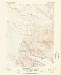
1952 Map of Kenai A-2
USGS Topo · Published 1954About this map
The Kenai National Moose Range dominates this mid-century wilderness landscape, where the massive Tustumena Glacier feeds into the southeastern reaches of Tustumena Lake. The map details a transition from high glacial peaks, including VABM 2823 Glacier, down through several watercourses such as Glacier Creek and Indian Creek. Human presence is sparse, indicated only by scattered Cabin and Cabins locations, likely serving hunters or surveyors within the range. The intricate drainage patterns of the Funny River and Moose Creek reveal the complex hydrology of the peninsula before modern development. Notable landmarks like Lake Emma and the sheltered Devils Bay provide reference points for those tracing historical backcountry routes or early wildlife management boundaries in the Third Judicial Division.
Find a feature on this map
16 named features on this map. Tap any name to fly to it.
Don’t see what you’re looking for? This feature index may not catch every label — zoom into the map to look around manually.
Map Details
Editions of this 1952 Kenai A-2 Map
2 editions found

Other maps of this area

1944 · Kenai
USGS Topo · 1:250,000

1950 · Kenai
USGS Topo · 1:250,000

1950 · Kenai B-1
USGS Topo · 1:63,360

1950 · Seldovia D-2
USGS Topo · 1:63,360

1950 · Kenai B-3
USGS Topo · 1:63,360

1951 · Seldovia
USGS Topo · 1:250,000

1951 · Seldovia D-3
USGS Topo · 1:63,360

1951 · Kenai B-2
USGS Topo · 1:63,360

1951 · Kenai A-3
USGS Topo · 1:63,360

1951 · Kenai A-2
USGS Topo · 1:63,360