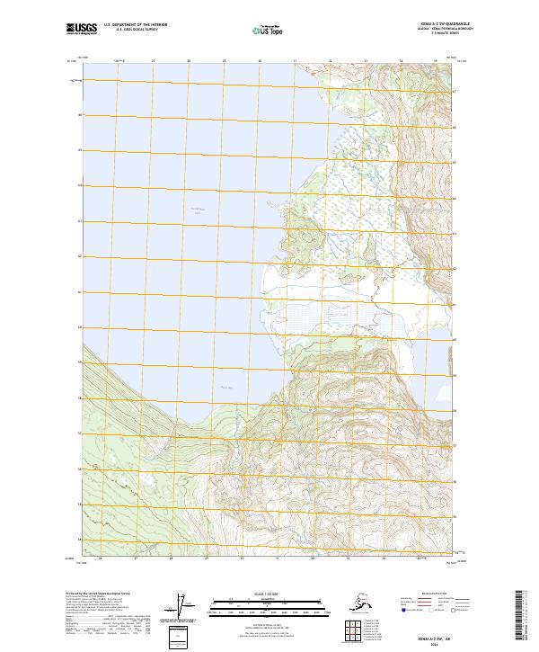
2024 Map of Kenai A-2 SW
USGS Topo · Published 2024About this map
Tustumena Lake dominates the western half of this quadrangle, its deep waters meeting a complex shoreline defined by Devils Bay. The eastern landscape is characterized by the rugged transition from lowland marshes to high glacial drainages within the Kenai Wilderness. This protected area, part of the Kenai National Wildlife Refuge, preserves a wilderness mostly untouched by modern infrastructure. Waterways such as Glacier Creek and Clear Creek descend from the steep eastern elevations, illustrating the primary drainage patterns that feed into the larger lake system. The absence of roads or permanent settlements highlights the area's role as a biological stronghold and primitive recreation zone on the Kenai Peninsula.
Find a feature on this map
12 named features on this map. Tap any name to fly to it.
Don’t see what you’re looking for? This feature index may not catch every label — zoom into the map to look around manually.
Map Details
Editions of this 2024 Kenai A-2 SW Map
This is the sole edition of this map. No revisions or reprints were ever made.
Other maps of this area

1944 · Kenai
USGS Topo · 1:250,000

1950 · Kenai
USGS Topo · 1:250,000

1950 · Seldovia D-2
USGS Topo · 1:63,360

1951 · Seldovia
USGS Topo · 1:250,000

1951 · Seldovia D-3
USGS Topo · 1:63,360

1951 · Kenai A-3
USGS Topo · 1:63,360

1951 · Kenai A-2
USGS Topo · 1:63,360

1952 · Kenai A-2
USGS Topo · 1:63,360

1952 · Kenai A-3
USGS Topo · 1:63,360

1953 · Seldovia D-2
USGS Topo · 1:63,360