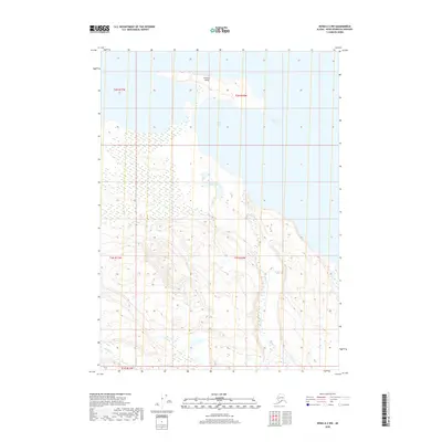
2018 Map of Kenai A-3 NW
USGS Topo · Published 2018About this map
Tustumena Lake dominates the eastern horizon of this coastal Kenai Peninsula landscape, where the waters of Nicolai Bay reach inland to meet a complex drainage system. The terrain is defined by the prominent Caribou Island and the meandering paths of Nicolai Cr and Crooked Cr, which cut through the low-lying wetlands and rising slopes. This 2018 survey illustrates a wilderness nearly devoid of modern infrastructure, centered instead on the natural hydrology of Nicolai Lake. The land is divided by the Public Land Survey System grids of t2n r10w and t1n r11w, reflecting the formal administrative boundaries that overlie this largely untouched coastal environment.
Find a feature on this map
11 named features on this map. Tap any name to fly to it.
Don’t see what you’re looking for? This feature index may not catch every label — zoom into the map to look around manually.
Map Details
Editions of this 2018 Kenai A-3 NW Map
This is the sole edition of this map. No revisions or reprints were ever made.
Other maps of this area

1944 · Kenai
USGS Topo · 1:250,000

1950 · Kenai
USGS Topo · 1:250,000

1950 · Kenai B-3
USGS Topo · 1:63,360

1951 · Kenai A-3
USGS Topo · 1:63,360

1951 · Kenai B-4
USGS Topo · 1:63,360

1951 · Kenai A-4
USGS Topo · 1:63,360

1952 · Kenai B-3
USGS Topo · 1:63,360

1952 · Kenai B-4
USGS Topo · 1:63,360

1952 · Kenai A-3
USGS Topo · 1:63,360

1952 · Kenai A-4
USGS Topo · 1:63,360