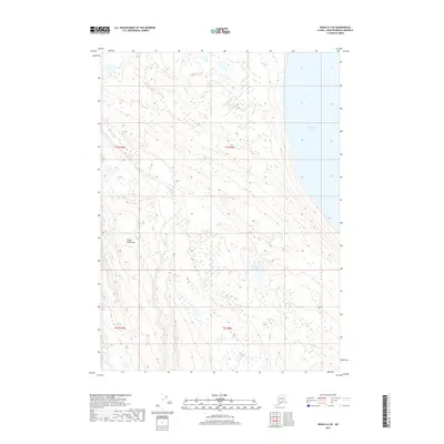
2017 Map of Kenai A-3 SE
USGS Topo · Published 2017About this map
Tustumena Lake dominates the eastern boundary of this maritime landscape on the Kenai Peninsula, where glacial melt and coastal drainage systems define the geography. The map illustrates a complex network of waterways, including the meandering Nikolai Cr and Fox Cr, which flow through a terrain marked by numerous unnamed ponds and wetlands. Small basins like Windy Lake are interspersed among the shifting contours, reflecting the dynamic hydrological environment of south-central Alaska. This 2017 survey provides a detailed look at the Public Land Survey System divisions, including t1s r9w and t2s r10w, which are essential for understanding land tenure and remote property boundaries in this undeveloped wilderness area.
Find a feature on this map
9 named features on this map. Tap any name to fly to it.
Don’t see what you’re looking for? This feature index may not catch every label — zoom into the map to look around manually.
Map Details
Editions of this 2017 Kenai A-3 SE Map
This is the sole edition of this map. No revisions or reprints were ever made.
Other maps of this area

1944 · Kenai
USGS Topo · 1:250,000

1950 · Kenai
USGS Topo · 1:250,000

1950 · Seldovia D-2
USGS Topo · 1:63,360

1951 · Seldovia
USGS Topo · 1:250,000

1951 · Seldovia D-3
USGS Topo · 1:63,360

1951 · Kenai A-3
USGS Topo · 1:63,360

1951 · Kenai A-2
USGS Topo · 1:63,360

1952 · Kenai A-2
USGS Topo · 1:63,360

1952 · Kenai A-3
USGS Topo · 1:63,360

1953 · Seldovia D-2
USGS Topo · 1:63,360