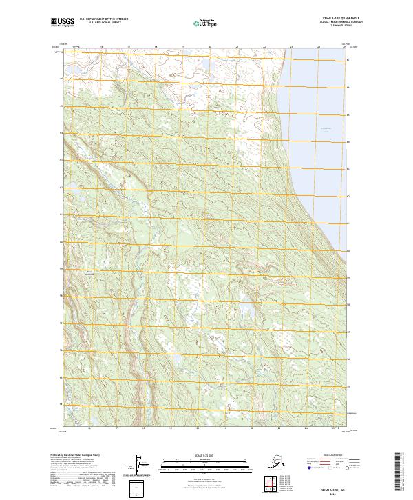
2024 Map of Kenai A-3 SE
USGS Topo · Published 2024About this map
Kenai National Wildlife Refuge encompasses the majority of this landscape, showcasing a complex network of wetlands and small water bodies characteristic of the Kenai Peninsula. The map details the transition from the protected marshes of the Kenai Wilderness (Andrew Simons Unit) to the western shore of Tustumena Lake. This environment is defined by its drainages, where Fox Creek and Nikolai Creek navigate through the low-lying terrain, creating a habitat that remains largely undeveloped and preserved. The inclusion of the Andrew Simons Unit highlights a specific focus on wilderness management within the larger refuge system. Researchers can examine the precise hydrography of this region, which remains a critical component of the peninsula's ecosystem.
Find a feature on this map
10 named features on this map. Tap any name to fly to it.
Don’t see what you’re looking for? This feature index may not catch every label — zoom into the map to look around manually.
Map Details
Editions of this 2024 Kenai A-3 SE Map
This is the sole edition of this map. No revisions or reprints were ever made.
Other maps of this area

1944 · Kenai
USGS Topo · 1:250,000

1950 · Kenai
USGS Topo · 1:250,000

1950 · Seldovia D-2
USGS Topo · 1:63,360

1951 · Seldovia
USGS Topo · 1:250,000

1951 · Seldovia D-3
USGS Topo · 1:63,360

1951 · Kenai A-3
USGS Topo · 1:63,360

1951 · Kenai A-2
USGS Topo · 1:63,360

1952 · Kenai A-2
USGS Topo · 1:63,360

1952 · Kenai A-3
USGS Topo · 1:63,360

1953 · Seldovia D-2
USGS Topo · 1:63,360