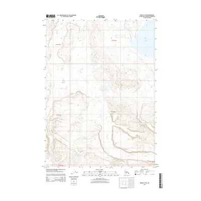
2014 Map of Kenai A-4 NE
USGS Topo · Published 2014About this map
The glacial waters of Tustumena Lake dominate the eastern margin of this terrain on the Kenai Peninsula. The landscape is defined by the drainage of the Kasilof River, which flows northwest away from the lake's massive basin. Smaller bodies of water like Berg Lake and Border Lake punctuate the higher ground, while the intricate paths of Crooked Cr and the upper reaches of the Ninilchik River carve through the western portions of the survey area. This 2014 mapping provides a detailed look at the hydrological network before these systems reach the more settled coastal corridors of the peninsula, showing a wilderness still largely shaped by water and elevation.
Find a feature on this map
11 named features on this map. Tap any name to fly to it.
Don’t see what you’re looking for? This feature index may not catch every label — zoom into the map to look around manually.
Map Details
Editions of this 2014 Kenai A-4 NE Map
This is the sole edition of this map. No revisions or reprints were ever made.
Other maps of this area

1944 · Kenai
USGS Topo · 1:250,000

1950 · Kenai
USGS Topo · 1:250,000

1950 · Kenai B-3
USGS Topo · 1:63,360

1951 · Kenai A-3
USGS Topo · 1:63,360

1951 · Kenai B-4
USGS Topo · 1:63,360

1951 · Kenai A-4
USGS Topo · 1:63,360

1952 · Kenai B-3
USGS Topo · 1:63,360

1952 · Kenai B-4
USGS Topo · 1:63,360

1952 · Kenai A-3
USGS Topo · 1:63,360

1952 · Kenai A-4
USGS Topo · 1:63,360