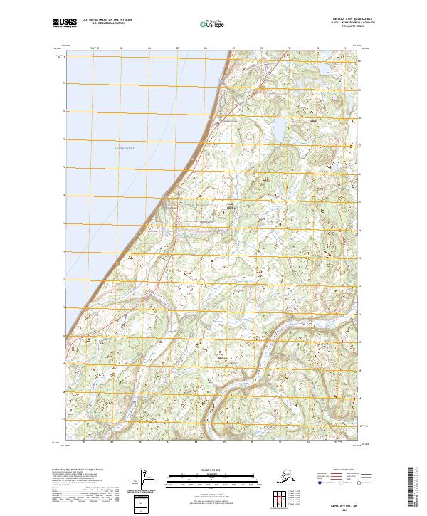
2024 Map of Kenai A-4 NW
USGS Topo · Published 2024About this map
The eastern shores of Cook Inlet define this landscape, where the Sterling Highway serves as the primary artery connecting the coastal settlements of the Kenai Peninsula. This modern survey illustrates the residential expansion around Clam Gulch and Cohoe, characterized by a network of local roads with names like Homestead Drive and Clammers Haven Drive that hint at the region's cultural identity and land-use history. The terrain is marked by the winding course of the Ninilchik River and Falls Creek, which flow through wetland complexes and forested tracts toward the inlet.
Find a feature on this map
28 named features on this map. Tap any name to fly to it.
Don’t see what you’re looking for? This feature index may not catch every label — zoom into the map to look around manually.
Map Details
Editions of this 2024 Kenai A-4 NW Map
This is the sole edition of this map. No revisions or reprints were ever made.
Other maps of this area

1944 · Kenai
USGS Topo · 1:250,000

1950 · Kenai
USGS Topo · 1:250,000

1951 · Kenai A-5
USGS Topo · 1:63,360

1951 · Kenai B-4
USGS Topo · 1:63,360

1951 · Kenai A-4
USGS Topo · 1:63,360

1952 · Kenai A-5
USGS Topo · 1:63,360

1952 · Kenai B-4
USGS Topo · 1:63,360

1952 · Kenai A-4
USGS Topo · 1:63,360

1958 · Kenai
USGS Topo · 1:250,000
1986 · Kenai B-4 SW
USGS Topo · 1:25,000