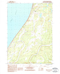
1987 Map of Kenai A-4 NW
USGS Topo · Published 1987About this map
Clam Gulch and the surrounding coastline of the Cook Inlet dominate this 1980s coastal survey of the Kenai Peninsula. The landscape is defined by the drainage of the Ninilchik River and Corea Creek, which cut through the bluff-lined shore. Coastal infrastructure is concentrated near the northern bluffs, where a Campground, Radio Tower, and Landing Strip serve the local area. Moving inland, the map documents a series of unnamed topographic features and seasonal routes, most notably the Winter Trail and a Trans Line corridor that parallel the coast. Evidence of local activity is seen in the Gravel Pit and a designated Falls on a small drainage. The geography here is typical of the peninsula's western edge before late-century development, where transportation relied heavily on these established trails and maritime access.
Find a feature on this map
16 named features on this map. Tap any name to fly to it.
Don’t see what you’re looking for? This feature index may not catch every label — zoom into the map to look around manually.
Map Details
Editions of this 1987 Kenai A-4 NW Map
This is the sole edition of this map. No revisions or reprints were ever made.
Other maps of this area

1944 · Kenai
USGS Topo · 1:250,000

1950 · Kenai
USGS Topo · 1:250,000

1951 · Kenai A-5
USGS Topo · 1:63,360

1951 · Kenai B-4
USGS Topo · 1:63,360

1951 · Kenai A-4
USGS Topo · 1:63,360

1952 · Kenai A-5
USGS Topo · 1:63,360

1952 · Kenai B-4
USGS Topo · 1:63,360

1952 · Kenai A-4
USGS Topo · 1:63,360

1958 · Kenai
USGS Topo · 1:250,000
1986 · Kenai B-4 SW
USGS Topo · 1:25,000