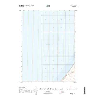
2018 Map of Kenai A-5 NE
USGS Topo · Published 2018About this map
The Pacific Ocean dominates this coastal survey, where the marine environment meets the southwestern edge of the Kenai Peninsula. The landscape transition is marked by a relatively narrow coastal corridor where infrastructure clings to the shoreline. The Sterling Highway serves as the primary artery for the region, paralleled by more localized developments like Coho Bend Road. This 2018 edition illustrates the modern transportation grid in a region defined by its maritime proximity, showing the township and range divisions of t2n r13w, t1n r13w, and t1s r14w that organize this corner of Alaska. The map provides a precise look at how the terrestrial road network terminates against the vast water bodies of the north.
Find a feature on this map
6 named features on this map. Tap any name to fly to it.
Don’t see what you’re looking for? This feature index may not catch every label — zoom into the map to look around manually.
Map Details
Editions of this 2018 Kenai A-5 NE Map
This is the sole edition of this map. No revisions or reprints were ever made.
Other maps of this area

1944 · Kenai
USGS Topo · 1:250,000

1950 · Kenai
USGS Topo · 1:250,000

1951 · Kenai A-5
USGS Topo · 1:63,360

1951 · Kenai B-4
USGS Topo · 1:63,360

1951 · Kenai A-4
USGS Topo · 1:63,360

1952 · Kenai A-5
USGS Topo · 1:63,360

1952 · Kenai B-4
USGS Topo · 1:63,360

1952 · Kenai A-4
USGS Topo · 1:63,360

1958 · Kenai
USGS Topo · 1:250,000
1986 · Kenai B-4 SW
USGS Topo · 1:25,000