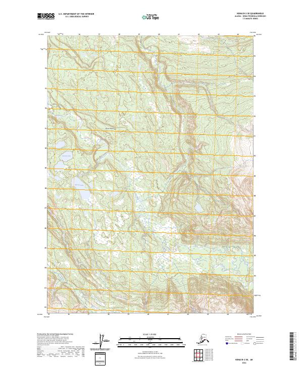
2024 Map of Kenai B-2 SE
USGS Topo · Published 2024About this map
The Kenai Peninsula interior is defined by a dense network of glacial meltwater and complex hydrography within the Kenai National Wildlife Refuge. The landscape is dominated by the winding course of the Killey River in the north and the Funny River in the southwest, separated by a high-elevation ridge system that peaks within the Kenai Wilderness (Andrew Simons Unit). This protected corridor remains largely devoid of modern development, preserving the primitive character of the Alaskan wilderness. Isolated water bodies like Round Lake and Harvey Lake are scattered through the lower elevations, marking the transition from riverine valleys to the upland terrain. The map emphasizes the ecological continuity of the area, showing the intricate contouring of the Kenai mountains as they drop toward the river basins.
Find a feature on this map
11 named features on this map. Tap any name to fly to it.
Don’t see what you’re looking for? This feature index may not catch every label — zoom into the map to look around manually.
Map Details
Editions of this 2024 Kenai B-2 SE Map
This is the sole edition of this map. No revisions or reprints were ever made.
Other maps of this area

1944 · Kenai
USGS Topo · 1:250,000

1950 · Kenai
USGS Topo · 1:250,000

1950 · Kenai B-1
USGS Topo · 1:63,360

1951 · Kenai B-2
USGS Topo · 1:63,360

1951 · Kenai A-2
USGS Topo · 1:63,360

1951 · Kenai A-1
USGS Topo · 1:63,360

1952 · Kenai B-2
USGS Topo · 1:63,360

1952 · Kenai A-1
USGS Topo · 1:63,360

1952 · Kenai B-1
USGS Topo · 1:63,360

1952 · Kenai A-2
USGS Topo · 1:63,360