
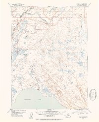
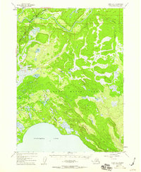
1952 Map of Kenai B-3
USGS Topo · Published 1954About this map
Soldotna serves as the focal point for this 1950s survey of the central Kenai Peninsula, situated at the junction of the Sterling Highway and the Kenai River. The settlement pattern at this time shows the early footprint of development near the bridge, surrounded by a landscape dominated by the Kenai National Moose Range. This protected area covers much of the southern and eastern territory, characterized by an intricate network of wetlands and smaller bodies of water like Coal Creek Lake and Slikok Lake.
Find a feature on this map
18 named features on this map. Tap any name to fly to it.
Don’t see what you’re looking for? This feature index may not catch every label — zoom into the map to look around manually.
Map Details
Editions of this 1952 Kenai B-3 Map
3 editions found
Other maps of this area

1944 · Kenai
USGS Topo · 1:250,000

1950 · Kenai
USGS Topo · 1:250,000

1950 · Kenai C-3
USGS Topo · 1:63,360

1950 · Kenai B-3
USGS Topo · 1:63,360

1951 · Kenai B-2
USGS Topo · 1:63,360

1951 · Kenai C-2
USGS Topo · 1:63,360

1951 · Kenai A-3
USGS Topo · 1:63,360

1951 · Kenai A-2
USGS Topo · 1:63,360

1951 · Kenai C-4
USGS Topo · 1:63,360

1951 · Kenai C-3
USGS Topo · 1:63,360