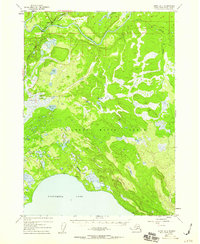
1952 Map of Kenai B-3
USGS Topo · Published 1959About this map
The settlement of Soldatna stands at a critical junction in the early 1950s, located where the Sterling Highway crosses the Kenai River. This era captures the Kenai Peninsula during a period of transition, as modern road access began to influence the landscape of the Kenai National Moose Range. The river system is central to the area's geography, with the Funny River and Soldatna Creek feeding into the main channel.
Find a feature on this map
13 named features on this map. Tap any name to fly to it.
Don’t see what you’re looking for? This feature index may not catch every label — zoom into the map to look around manually.
Map Details
Editions of this 1952 Kenai B-3 Map
3 editions found

Other maps of this area

1944 · Kenai
USGS Topo · 1:250,000

1950 · Kenai
USGS Topo · 1:250,000

1950 · Kenai C-3
USGS Topo · 1:63,360

1950 · Kenai B-3
USGS Topo · 1:63,360

1951 · Kenai B-2
USGS Topo · 1:63,360

1951 · Kenai C-2
USGS Topo · 1:63,360

1951 · Kenai A-3
USGS Topo · 1:63,360

1951 · Kenai A-2
USGS Topo · 1:63,360

1951 · Kenai C-4
USGS Topo · 1:63,360

1951 · Kenai C-3
USGS Topo · 1:63,360