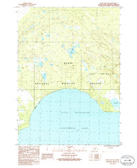
1986 Map of Kenai B-3 SW
USGS Topo · Published 1986About this map
Tustumena Lake dominates the southern landscape of this 1980s field study, its northern shoreline defining the boundary of the Kenai Wilderness. This region is a complex network of glacial remnants and interior water bodies within the Kenai National Wildlife Refuge, where the topography is marked by dozens of small, unnamed kettle lakes and wetlands. The drainage systems are clearly defined, featuring Shantatalik Creek as it winds toward the larger lake, and significant interior bodies such as Bay Lake and Trail Lake. The map illustrates the transition from the low-lying lacustrine environment of the south to the higher, undulating terrain of the Kenai Peninsula interior, all set within a strictly protected environmental corridor. For researchers of the peninsula's geography, the sheet documents the precise Wilderness Boundary and the undeveloped character of the land before late-twentieth-century shifts in conservation management.
Find a feature on this map
9 named features on this map. Tap any name to fly to it.
Don’t see what you’re looking for? This feature index may not catch every label — zoom into the map to look around manually.
Map Details
Editions of this 1986 Kenai B-3 SW Map
This is the sole edition of this map. No revisions or reprints were ever made.
Other maps of this area

1944 · Kenai
USGS Topo · 1:250,000

1950 · Kenai
USGS Topo · 1:250,000

1950 · Kenai B-3
USGS Topo · 1:63,360

1951 · Kenai A-3
USGS Topo · 1:63,360

1951 · Kenai B-4
USGS Topo · 1:63,360

1951 · Kenai A-4
USGS Topo · 1:63,360

1952 · Kenai B-3
USGS Topo · 1:63,360

1952 · Kenai B-4
USGS Topo · 1:63,360

1952 · Kenai A-3
USGS Topo · 1:63,360

1952 · Kenai A-4
USGS Topo · 1:63,360