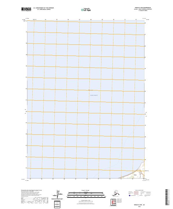
2024 Map of Kenai B-4 NW
USGS Topo · Published 2024About this map
Cook Inlet dominates the central and northern reaches of this coastal Alaskan landscape, where the shallow waters of Karluk Reef indicate the submerged hazards of the shoreline. The settlement of Cohoe is situated at the southeastern corner of the map, representing a small community node on the western Kenai Peninsula. Transport in this coastal area is primarily local, anchored by the route of Cohoe Beach Road which skirts the waterline. Much of the mapped territory covers the inlet waters, reflecting the maritime geography of the region. The map also delineates the formal land divisions of the Public Land Survey System, including portions of t5n r12w, t4n r12w, t3n r12w, and t3n r13w. These boundary lines serve as essential guides for understanding land ownership and administrative divisions in this part of the Kenai Peninsula Borough.
Find a feature on this map
8 named features on this map. Tap any name to fly to it.
Don’t see what you’re looking for? This feature index may not catch every label — zoom into the map to look around manually.
Map Details
Editions of this 2024 Kenai B-4 NW Map
This is the sole edition of this map. No revisions or reprints were ever made.
Other maps of this area

1944 · Kenai
USGS Topo · 1:250,000

1950 · Kenai
USGS Topo · 1:250,000

1951 · Kenai C-4
USGS Topo · 1:63,360

1951 · Kenai B-4
USGS Topo · 1:63,360

1952 · Kenai C-4
USGS Topo · 1:63,360

1952 · Kenai B-4
USGS Topo · 1:63,360

1958 · Kenai C-5
USGS Topo · 1:63,360

1958 · Kenai
USGS Topo · 1:250,000
1986 · Kenai B-4 NW
USGS Topo · 1:25,000
1986 · Kenai B-4 SW
USGS Topo · 1:25,000