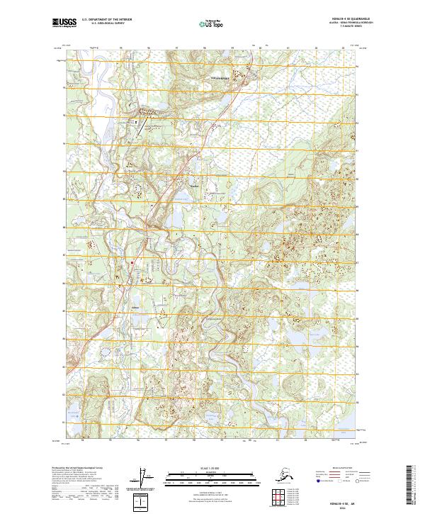
2024 Map of Kenai B-4 SE
USGS Topo · Published 2024About this map
The Kasilof River winds through the heart of the Kenai Peninsula, serving as a central artery for the settlements of Kasilof and Cohoe. This modern survey details a landscape where traditional aviation and local heritage intersect, featuring the Kasilof Airport alongside the Spruce Grove Memorial Cem. To the north, the community of Kalifornsky borders a network of residential roads like Sydney Ann Avenue and Ariels Lane that branch off the Sterling Highway.
Find a feature on this map
89 named features on this map. Tap any name to fly to it.
Don’t see what you’re looking for? This feature index may not catch every label — zoom into the map to look around manually.
Map Details
Editions of this 2024 Kenai B-4 SE Map
This is the sole edition of this map. No revisions or reprints were ever made.
Other maps of this area

1944 · Kenai
USGS Topo · 1:250,000

1950 · Kenai
USGS Topo · 1:250,000

1950 · Kenai B-3
USGS Topo · 1:63,360

1951 · Kenai A-3
USGS Topo · 1:63,360

1951 · Kenai B-4
USGS Topo · 1:63,360

1951 · Kenai A-4
USGS Topo · 1:63,360

1952 · Kenai B-3
USGS Topo · 1:63,360

1952 · Kenai B-4
USGS Topo · 1:63,360

1952 · Kenai A-3
USGS Topo · 1:63,360

1952 · Kenai A-4
USGS Topo · 1:63,360