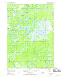
1951 Map of Kenai C-2
USGS Topo · Published 1969About this map
Kenai National Moose Range dominates this landscape on the Kenai Peninsula, where a complex network of glacial lakes and rivers defines the interior wilderness. In the early 1950s, the southern portion of the sheet shows emerging infrastructure along the Sterling Highway, including the Naptowne Lodge and a nearby Landing Strip. This area reflects a mid-century moment when the remote Alaskan backcountry was becoming accessible via new road corridors, while the vast majority of the terrain remained an unsurveyed expanse of wetlands and small water bodies like Porcupine Lake and Big Merganser Lake. The map records specific early human footprints such as a Gravel Pit and isolated Cabin sites, contrasting with the preservation of the surrounding moose range and its intricate waterways like the Swanson River.
Find a feature on this map
75 named features on this map. Tap any name to fly to it.
Don’t see what you’re looking for? This feature index may not catch every label — zoom into the map to look around manually.
Map Details
Editions of this 1951 Kenai C-2 Map
3 editions found
Other maps of this area

1944 · Kenai
USGS Topo · 1:250,000

1950 · Kenai
USGS Topo · 1:250,000

1950 · Kenai C-3
USGS Topo · 1:63,360

1950 · Kenai B-1
USGS Topo · 1:63,360

1950 · Kenai B-3
USGS Topo · 1:63,360

1951 · Kenai D-3
USGS Topo · 1:63,360

1951 · Kenai B-2
USGS Topo · 1:63,360

1951 · Kenai C-1
USGS Topo · 1:63,360

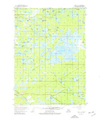
1951 · Kenai C-2
USGS Topo · 1:63,360

1951 · Kenai D-1
USGS Topo · 1:63,360