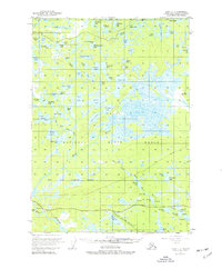
1951 Map of Kenai C-2
USGS Topo · Published 1977About this map
Kenai National Moose Range dominates this mid-century landscape of the Kenai Peninsula, characterized by an intricate network of kettle lakes and meandering waterways. Near the southern edge, the small settlement of Naptowne sits along a prominent bend in the river, served by a Landing Strip and the emerging Skilak Lake Road. The interior is defined by hundreds of distinct water bodies such as Big Merganser Lake, Coyote Lake, and Campfire Lake, reflecting a glacial terrain that, at the time of this 1950s-era survey, remained largely unsurveyed by the Bureau of Land Management except for these essential topographic landmarks. The presence of a Pipeline and scattered Gravel Pits suggests the early footprint of infrastructure developments within the federal wildlife reservation.
Find a feature on this map
81 named features on this map. Tap any name to fly to it.
Don’t see what you’re looking for? This feature index may not catch every label — zoom into the map to look around manually.
Map Details
Editions of this 1951 Kenai C-2 Map
3 editions found
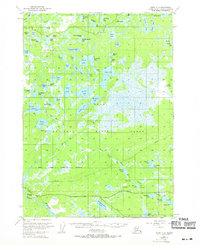
Other maps of this area

1944 · Kenai
USGS Topo · 1:250,000

1950 · Kenai
USGS Topo · 1:250,000

1950 · Kenai C-3
USGS Topo · 1:63,360

1950 · Kenai B-1
USGS Topo · 1:63,360

1950 · Kenai B-3
USGS Topo · 1:63,360

1951 · Kenai D-3
USGS Topo · 1:63,360

1951 · Kenai B-2
USGS Topo · 1:63,360

1951 · Kenai C-1
USGS Topo · 1:63,360

1951 · Kenai C-2
USGS Topo · 1:63,360

1951 · Kenai D-1
USGS Topo · 1:63,360