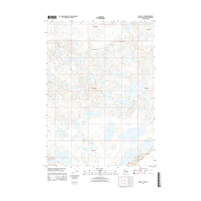
2014 Map of Kenai C-2 NW
USGS Topo · Published 2014About this map
Swanson River and its tributary Swan Cr dominate the northern landscape of this Kenai Peninsula region, defining a complex wetland ecosystem of interconnecting waterways and glacial lakes. In the center of the sheet, the Canoe Lake Chain offers a unique view into the area's recreational and transport routes, with Swan Lake Road providing the primary overland access through the dense network of water bodies. Names such as Skookum Lake, Doghouse Lake, and Porcupine Lake reflect a landscape shaped by local identification and outdoor use. The map illustrates a high-density lake region including Big Merganser Lake, Little Merganser Lake, and Konchanee Lake, providing a clear record of the peninsula's hydrography and township boundaries in the early 21st century.
Find a feature on this map
47 named features on this map. Tap any name to fly to it.
Don’t see what you’re looking for? This feature index may not catch every label — zoom into the map to look around manually.
Map Details
Editions of this 2014 Kenai C-2 NW Map
This is the sole edition of this map. No revisions or reprints were ever made.
Other maps of this area

1944 · Kenai
USGS Topo · 1:250,000

1950 · Kenai
USGS Topo · 1:250,000

1950 · Kenai C-3
USGS Topo · 1:63,360

1951 · Kenai D-3
USGS Topo · 1:63,360

1951 · Kenai C-2
USGS Topo · 1:63,360

1951 · Kenai D-2
USGS Topo · 1:63,360

1951 · Kenai C-3
USGS Topo · 1:63,360

1952 · Kenai D-3
USGS Topo · 1:63,360

1952 · Kenai D-2
USGS Topo · 1:63,360

1952 · Kenai C-2
USGS Topo · 1:63,360