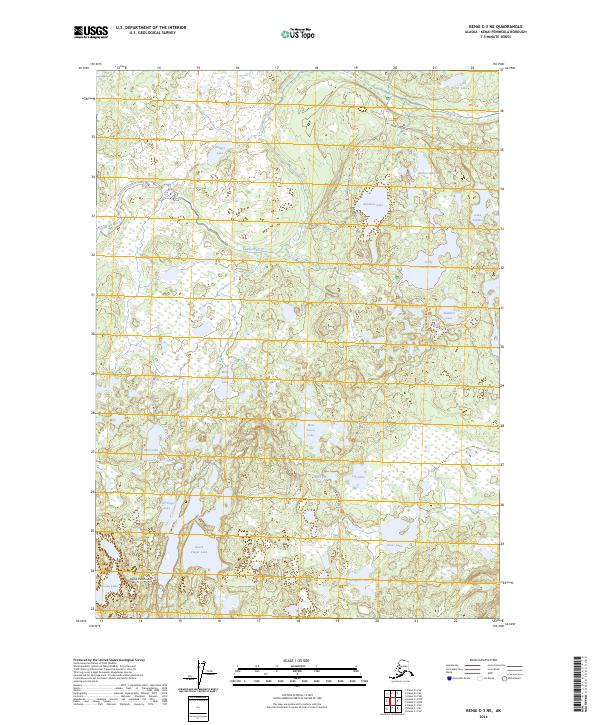
2024 Map of Kenai C-3 NE
USGS Topo · Published 2024About this map
The Kenai National Wildlife Refuge dominates this section of the Kenai Peninsula, revealing a landscape defined by an intricate network of kettle lakes and wetlands. The Swanson River meanders across the northern terrain, providing a vital waterway through the protected Kenai Wilderness (Dave Spencer Unit). This modern survey illustrates the preservation of a vast muskeg and boreal forest environment, where access is primarily limited to rugged paths like the Drake Skookum Lakes Trl and Silver Lake Trl. Significant water bodies such as South Finger Lake, Hungry Lake, and Dolly Varden Lake are scattered throughout, highlighting the glacial legacy of the region. The map tracks the minimal infrastructure permitted in this wilderness, including the Swanson River Road and Swan Lake Road, which skirt the edges of these protected habitats.
Find a feature on this map
34 named features on this map. Tap any name to fly to it.
Don’t see what you’re looking for? This feature index may not catch every label — zoom into the map to look around manually.
Map Details
Editions of this 2024 Kenai C-3 NE Map
This is the sole edition of this map. No revisions or reprints were ever made.
Other maps of this area

1944 · Kenai
USGS Topo · 1:250,000

1950 · Kenai
USGS Topo · 1:250,000

1950 · Kenai C-3
USGS Topo · 1:63,360

1951 · Kenai D-3
USGS Topo · 1:63,360

1951 · Kenai C-2
USGS Topo · 1:63,360

1951 · Kenai D-2
USGS Topo · 1:63,360

1951 · Kenai C-3
USGS Topo · 1:63,360

1952 · Kenai D-3
USGS Topo · 1:63,360

1952 · Kenai D-2
USGS Topo · 1:63,360

1952 · Kenai C-2
USGS Topo · 1:63,360