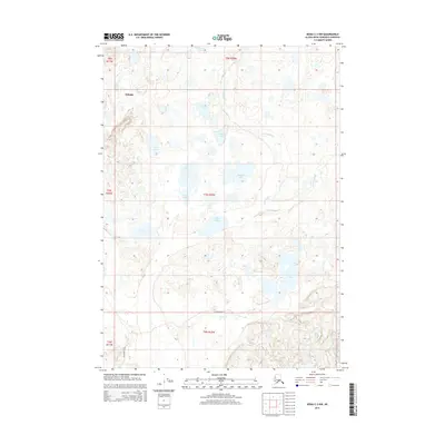
2014 Map of Kenai C-3 NW
USGS Topo · Published 2014About this map
Nikiski serves as the primary settlement hub in this portion of the northern Kenai Peninsula, situated near a landscape defined by an intricate network of wetlands and namesake lakes. The Swanson River meanders through the eastern section of the quadrangle, drawing from and feeding into numerous water bodies such as Shadura Lake and Killdeer Lake. This area reflects the mid-20th-century expansion of infrastructure into the Alaskan wilderness, evidenced by the presence of Marathon Road which provides access through the southwestern reaches. The terrain is characterized by a high density of small lakes, including Ermine Lake, Akula Lake, and Lake Ootka, illustrating the glacial geomorphology of the region. These water systems, including Beaver Cr and Bishop Cr, form a complex drainage pattern that has historically influenced the distribution of local homesteads and industrial access points.
Find a feature on this map
21 named features on this map. Tap any name to fly to it.
Don’t see what you’re looking for? This feature index may not catch every label — zoom into the map to look around manually.
Map Details
Editions of this 2014 Kenai C-3 NW Map
This is the sole edition of this map. No revisions or reprints were ever made.
Other maps of this area

1944 · Kenai
USGS Topo · 1:250,000

1950 · Kenai
USGS Topo · 1:250,000

1950 · Kenai C-3
USGS Topo · 1:63,360

1950 · Kenai D-4
USGS Topo · 1:63,360

1951 · Kenai D-3
USGS Topo · 1:63,360

1951 · Kenai C-4
USGS Topo · 1:63,360

1951 · Kenai C-3
USGS Topo · 1:63,360

1952 · Kenai D-3
USGS Topo · 1:63,360

1952 · Kenai D-4
USGS Topo · 1:63,360

1952 · Kenai C-4
USGS Topo · 1:63,360