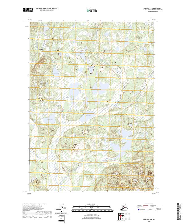
2024 Map of Kenai C-3 NW
USGS Topo · Published 2024About this map
The Kenai National Wildlife Refuge dominates this modern topographical study, revealing a complex landscape of glacial kettle lakes and marshlands on the Kenai Peninsula. The settlement of Nikiski is situated in the northwest corner, with Josie Street and Marathon Road providing limited vehicle access through the dense wetland network. A high concentration of named water bodies, including Shadura Lake, Lake Ootka, and Akula Lake, illustrates the intricate hydrology of the region. The Swanson River winds through the northeastern section, while Bishop Creek and Beaver Creek drain the western and southern reaches. This 2024 data reflects the contemporary state of these protected lands, capturing the intersection of local infrastructure and preserved wilderness near the Cook Inlet coast.
Find a feature on this map
23 named features on this map. Tap any name to fly to it.
Don’t see what you’re looking for? This feature index may not catch every label — zoom into the map to look around manually.
Map Details
Editions of this 2024 Kenai C-3 NW Map
This is the sole edition of this map. No revisions or reprints were ever made.
Other maps of this area

1944 · Kenai
USGS Topo · 1:250,000

1950 · Kenai
USGS Topo · 1:250,000

1950 · Kenai C-3
USGS Topo · 1:63,360

1950 · Kenai D-4
USGS Topo · 1:63,360

1951 · Kenai D-3
USGS Topo · 1:63,360

1951 · Kenai C-4
USGS Topo · 1:63,360

1951 · Kenai C-3
USGS Topo · 1:63,360

1952 · Kenai D-3
USGS Topo · 1:63,360

1952 · Kenai D-4
USGS Topo · 1:63,360

1952 · Kenai C-4
USGS Topo · 1:63,360