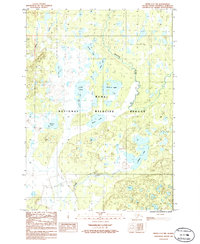
1986 Map of Kenai C-3 NW
USGS Topo · Published 1986About this map
The Kenai National Wildlife Refuge dominates this northern peninsula landscape, characterized by a complex network of glacial kettle lakes and marshy lowlands. The central drainage is anchored by the Swanson River and its meandering tributaries, including Bishop Creek and Beaver Creek. The 1980s terrain shows a clear intersection of conservation land and resource infrastructure, with a prominent Pipeline and Trans Line Pipeline cutting across the northwestern quadrant through the muskeg and spruce flats.
Find a feature on this map
19 named features on this map. Tap any name to fly to it.
Don’t see what you’re looking for? This feature index may not catch every label — zoom into the map to look around manually.
Map Details
Editions of this 1986 Kenai C-3 NW Map
This is the sole edition of this map. No revisions or reprints were ever made.
Other maps of this area

1944 · Kenai
USGS Topo · 1:250,000

1950 · Kenai
USGS Topo · 1:250,000

1950 · Kenai C-3
USGS Topo · 1:63,360

1950 · Kenai D-4
USGS Topo · 1:63,360

1951 · Kenai D-3
USGS Topo · 1:63,360

1951 · Kenai C-4
USGS Topo · 1:63,360

1951 · Kenai C-3
USGS Topo · 1:63,360

1952 · Kenai D-3
USGS Topo · 1:63,360

1952 · Kenai D-4
USGS Topo · 1:63,360

1952 · Kenai C-4
USGS Topo · 1:63,360