2017 Map of Kenai D-1 NW
USGS Topo · Published 2017About this map
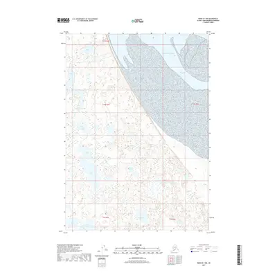
Chickaloon Bay and the tidal reaches of the Pacific Ocean dominate the eastern portion of this Kenai Peninsula landscape, where the sea meets a complex network of coastal wetlands. The terrain is characterized by a high density of small water bodies, suggesting a low-lying, saturated environment typical of the Alaskan coast. This hydrological pattern is defined by interconnected systems such as Bedlam Cr, which drains from Bedlam Lake, and Pincher Cr, flowing toward the coast. Farther inland, larger named basins like Dipper Lake, Tangerra Lake, and Lower Tangerra Lake dot the western interior. The absence of roads or structures in this area highlights its character as a preserved wilderness near the turn of the twenty-first century, where natural features like Mull Lake and Two Island Lake remain the primary points of orientation for researchers and outdoorsmen.
Find a feature on this map
19 named features on this map. Tap any name to fly to it.
Don’t see what you’re looking for? This feature index may not catch every label — zoom into the map to look around manually.
Map Details
Editions of this 2017 Kenai D-1 NW Map
This is the sole edition of this map. No revisions or reprints were ever made.
Other maps of this area

1944 · Kenai
USGS Topo · 1:250,000

1949 · Tyonek
USGS Topo · 1:250,000

1950 · Kenai
USGS Topo · 1:250,000

1951 · Tyonek
USGS Topo · 1:250,000

1951 · Kenai D-1
USGS Topo · 1:63,360

1951 · Kenai D-2
USGS Topo · 1:63,360

1951 · Tyonek A-2
USGS Topo · 1:63,360

1951 · Tyonek A-1
USGS Topo · 1:63,360

1952 · Kenai D-2
USGS Topo · 1:63,360

1952 · Tyonek A-2
USGS Topo · 1:63,360