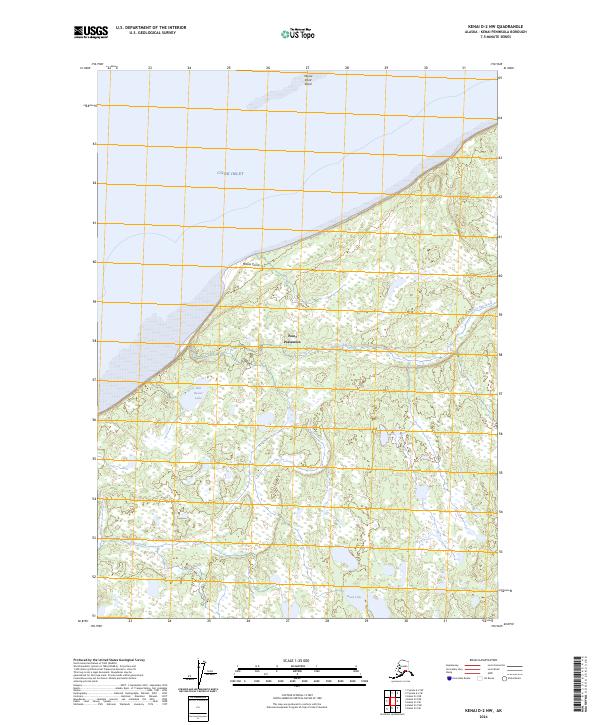
2024 Map of Kenai D-2 NW
USGS Topo · Published 2024About this map
Point Possession and the northern reaches of the Kenai National Wildlife Refuge define this coastal landscape along the Cook Inlet. The map depicts a wild, marshy stretch of the Kenai Peninsula, where numerous small lakes and meandering waterways like Seven Egg Creek and Otter Creek dominate the interior. The shoreline is marked by prominent geographical features such as Moose Point and the adjacent Moose Point Shoal, providing a clear record of the area's coastal morphology. This 2024 survey reflects a modern view of a largely uninhabited territory, focusing on the complex wetland systems and small water bodies like Bill Besser Lake and Hook Lake that characterize the refuge's interior.
Find a feature on this map
14 named features on this map. Tap any name to fly to it.
Don’t see what you’re looking for? This feature index may not catch every label — zoom into the map to look around manually.
Map Details
Editions of this 2024 Kenai D-2 NW Map
This is the sole edition of this map. No revisions or reprints were ever made.
Other maps of this area

1944 · Kenai
USGS Topo · 1:250,000

1949 · Tyonek
USGS Topo · 1:250,000

1950 · Kenai
USGS Topo · 1:250,000

1951 · Tyonek
USGS Topo · 1:250,000

1951 · Kenai D-3
USGS Topo · 1:63,360

1951 · Kenai D-2
USGS Topo · 1:63,360

1951 · Tyonek A-2
USGS Topo · 1:63,360

1952 · Kenai D-3
USGS Topo · 1:63,360

1952 · Kenai D-2
USGS Topo · 1:63,360

1952 · Tyonek A-2
USGS Topo · 1:63,360