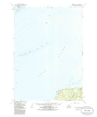
1950 Map of Kenai D-4
USGS Topo · Published 1986About this map
Cook Inlet dominates this mid-century survey, revealing the critical maritime and industrial geography of the Kenai Peninsula. The map highlights the early development of offshore energy resources, marking numerous installations such as Oil Platform Bruce, Oil Platform Anna, and Oil Platform Granite Point. These industrial landmarks stand in contrast to the natural hazards of the inlet, including the extensive Middle Ground Shoal and the shifting Tidal Flat zones.
Find a feature on this map
14 named features on this map. Tap any name to fly to it.
Don’t see what you’re looking for? This feature index may not catch every label — zoom into the map to look around manually.
Map Details
Editions of this 1950 Kenai D-4 Map
2 editions found
Other maps of this area

1944 · Kenai
USGS Topo · 1:250,000

1949 · Tyonek
USGS Topo · 1:250,000

1950 · Kenai
USGS Topo · 1:250,000

1950 · Kenai C-3
USGS Topo · 1:63,360

1950 · Kenai D-4
USGS Topo · 1:63,360

1951 · Tyonek
USGS Topo · 1:250,000

1951 · Kenai D-3
USGS Topo · 1:63,360

1951 · Kenai C-4
USGS Topo · 1:63,360

1951 · Kenai C-3
USGS Topo · 1:63,360

1952 · Kenai D-3
USGS Topo · 1:63,360