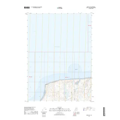
2018 Map of Kenai D-4 SE
USGS Topo · Published 2018About this map
The settlement of Nikiski occupies the southern coastline of this 2018 survey, where the terrestrial landscape meets the expansive Cook Inlet. This maritime environment is defined by prominent coastal landmarks like Boulder Point and the offshore Jumbo Rock, signaling a transition from the deep waters of the Pacific Ocean to the rugged shoreline of the Kenai Peninsula. In the interior, the terrain is characterized by numerous small bodies of water, including Suneva Lake and Cecille Lake, which are interspersed among a network of local thoroughfares.
Find a feature on this map
20 named features on this map. Tap any name to fly to it.
Don’t see what you’re looking for? This feature index may not catch every label — zoom into the map to look around manually.
Map Details
Editions of this 2018 Kenai D-4 SE Map
This is the sole edition of this map. No revisions or reprints were ever made.
Other maps of this area

1944 · Kenai
USGS Topo · 1:250,000

1950 · Kenai
USGS Topo · 1:250,000

1950 · Kenai C-3
USGS Topo · 1:63,360

1950 · Kenai D-4
USGS Topo · 1:63,360

1951 · Kenai D-3
USGS Topo · 1:63,360

1951 · Kenai C-4
USGS Topo · 1:63,360

1951 · Kenai C-3
USGS Topo · 1:63,360

1952 · Kenai D-3
USGS Topo · 1:63,360

1952 · Kenai D-4
USGS Topo · 1:63,360

1952 · Kenai C-4
USGS Topo · 1:63,360