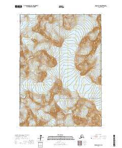
2017 Map of Kenai D-8 NW
USGS Topo · Published 2017About this map
Lake Clark National Park covers the southern portion of this high-elevation terrain in the Kenai Peninsula Borough, revealing a landscape dominated by ice and elevation. The map identifies two significant frozen features: Shamrock Glacier in the northwest and Tanaina Glacier situated centrally. This 2017 survey details the complex topography of the region, where the steep contour lines illustrate the sharp transitions between glacial valleys and mountain peaks. The absence of roads or settlements emphasizes the remote nature of this wilderness area, which is primarily managed for conservation and natural resource protection. Public Land Survey System grids, including t10n r21w and t10n r20w, provide the only geometric structure to this largely wild environment.
Find a feature on this map
9 named features on this map. Tap any name to fly to it.
Don’t see what you’re looking for? This feature index may not catch every label — zoom into the map to look around manually.
Map Details
Editions of this 2017 Kenai D-8 NW Map
This is the sole edition of this map. No revisions or reprints were ever made.
Other maps of this area

1944 · Kenai
USGS Topo · 1:250,000

1946 · Lake Clark
USGS Topo · 1:250,000

1949 · Tyonek
USGS Topo · 1:250,000

1950 · Kenai
USGS Topo · 1:250,000

1951 · Lake Clark
USGS Topo · 1:250,000

1951 · Tyonek
USGS Topo · 1:250,000

1951 · Lime Hills
USGS Topo · 1:250,000

1958 · Kenai D-8
USGS Topo · 1:63,360

1958 · Tyonek
USGS Topo · 1:250,000

1958 · Tyonek A-8
USGS Topo · 1:63,360