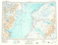
1944 Map of Kenai
USGS Topo · Published 1959About this map
Cook Inlet dominates this mid-century survey, dividing the towering Chigmit Mountains and Redoubt Volcano from the developing Kenai Peninsula. The map documents a pivotal era of infrastructure and resource development, showing the early route of the Sterling Highway and a scattering of oil wells north of the Kenai River. Along the eastern shore, the settlement of Kenai serves as a hub near the Military Reservation, while older coastal sites like Salamatof (Abandoned) and Kustatan indicate shifting habitation patterns. Industrial and agricultural life is represented by the Snug Harbor Cannery and family outposts such as Stelters Ranch and Jackinsky Ranch. Conservation boundaries are firmly established, including the Kenai National Moose Range and the Tuxedni National Wildlife Refuge, which protects the waters around Chisik Island.
Find a feature on this map
143 named features on this map. Tap any name to fly to it.
Don’t see what you’re looking for? This feature index may not catch every label — zoom into the map to look around manually.
Map Details
Editions of this 1944 Kenai Map
4 editions found
Other maps of this area

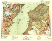
1944 · Kenai
USGS Topo · 1:250,000

1946 · Blying Sound
USGS Topo · 1:250,000

1946 · Lake Clark
USGS Topo · 1:250,000

1946 · Seldovia D-5
USGS Topo · 1:63,360

1949 · Tyonek
USGS Topo · 1:250,000

1949 · Seldovia D-4
USGS Topo · 1:63,360

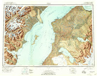
1950 · Kenai
USGS Topo · 1:250,000

1950 · Kenai C-3
USGS Topo · 1:63,360

1950 · Kenai B-1
USGS Topo · 1:63,360

1950 · Seldovia D-2
USGS Topo · 1:63,360