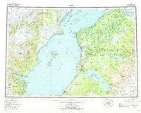
1958 Map of Kenai
USGS Topo · Published 1970About this map
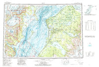
The Kenai National Moose Range dominates the eastern half of this survey, illustrating a mid-century landscape where wildlife conservation and industrial development began to converge. Early settlements such as Kenai, Soldotna, and Ninilchik are shown connected by the Sterling Highway, which provided the primary artery for growth on the peninsula. Offshore, a series of petroleum landmarks including Oil Platform Bruce and the Spark Oil Platform line the Gompertz Channel, marking the emergence of the Cook Inlet oil industry. To the west, the landscape shifts dramatically toward the Aleutian Range, where the towering Redoubt Volcano and massive Double Glacier overlook Redoubt Bay. This map captures a pivotal era as small fishing and indigenous outposts like Salamatof and Kustatan were joined by more modern developments like Nikishka No 1.
Find a feature on this map
128 named features on this map. Tap any name to fly to it.
Don’t see what you’re looking for? This feature index may not catch every label — zoom into the map to look around manually.
Map Details
Editions of this 1958 Kenai Map
6 editions found

Other maps of this area

1944 · Kenai
USGS Topo · 1:250,000

1946 · Blying Sound
USGS Topo · 1:250,000

1946 · Lake Clark
USGS Topo · 1:250,000

1946 · Seldovia D-5
USGS Topo · 1:63,360

1949 · Tyonek
USGS Topo · 1:250,000

1949 · Seldovia D-4
USGS Topo · 1:63,360

1950 · Kenai
USGS Topo · 1:250,000

1950 · Kenai C-3
USGS Topo · 1:63,360

1950 · Kenai B-1
USGS Topo · 1:63,360

1950 · Seldovia D-2
USGS Topo · 1:63,360