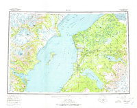
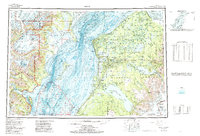
1958 Map of Kenai
USGS Topo · Published 1978About this map
Cook Inlet dominates this mid-century view of the Kenai Peninsula, where the offshore industrial presence is marked by a series of oil platforms including Oil Platform Anna and Oil Platform Baker in the Trading Bay and Gompertz Channel. On the mainland, the Sterling Highway links growing communities like Kenai, Soldotna, and Sterling, while large swaths of the interior are dedicated to the Kenai National Moose Range. The landscape is defined by its massive water bodies and glacial features, from the expansive Tustumena Lake and Skilak Lake to the towering Redoubt Volcano in the Aleutian Range across the inlet. The map captures a period of transition as traditional coastal settlements like Ninilchik and Salamatof are joined by modern infrastructure and resource extraction, framed by the Chigmit Mountains and the edge of the Harding Icefield.
Find a feature on this map
114 named features on this map. Tap any name to fly to it.
Don’t see what you’re looking for? This feature index may not catch every label — zoom into the map to look around manually.
Map Details
Editions of this 1958 Kenai Map
6 editions found

Other maps of this area

1944 · Kenai
USGS Topo · 1:250,000

1946 · Blying Sound
USGS Topo · 1:250,000

1946 · Lake Clark
USGS Topo · 1:250,000

1946 · Seldovia D-5
USGS Topo · 1:63,360

1949 · Tyonek
USGS Topo · 1:250,000

1949 · Seldovia D-4
USGS Topo · 1:63,360

1950 · Kenai
USGS Topo · 1:250,000

1950 · Kenai C-3
USGS Topo · 1:63,360

1950 · Kenai B-1
USGS Topo · 1:63,360

1950 · Seldovia D-2
USGS Topo · 1:63,360