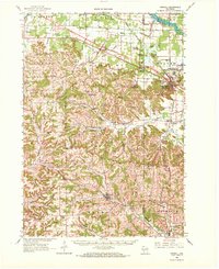
1962 Map of Kendall
USGS Topo · Published 1972About this map
Camp Williams and Volk Field dominate the northeastern corner of this 1962 survey, reflecting a landscape shaped by military training and aviation. The surrounding terrain is defined by dramatic bluff formations, including Devils Monument, Camels Hump, and Wildcat Bluff, which rise above the river valleys. The Little Lemonweir River and Lemonweir River networks provide the primary drainage for the region, where numerous small rural schools like Graf Sch and Tug Hollow Sch once served the scattered farmstead communities.
Find a feature on this map
104 named features on this map. Tap any name to fly to it.
Don’t see what you’re looking for? This feature index may not catch every label — zoom into the map to look around manually.
Map Details
Editions of this 1962 Kendall Map
2 editions found

Other maps of this area

1916 · Tomah
USGS Topo · 1:62,500

1919 · Kendall
USGS Topo · 1:62,500

1921 · Mauston
USGS Topo · 1:62,500

1921 · Kendall
USGS Topo · 1:62,500

1926 · La Farge
USGS Topo · 1:62,500

1927 · Hillsboro
USGS Topo · 1:62,500

1947 · Millston
USGS Topo · 1:62,500

1949 · Millston
USGS Topo · 1:62,500

1949 · Tomah
USGS Topo · 1:62,500

1953 · Eau Claire
USGS Topo · 1:250,000