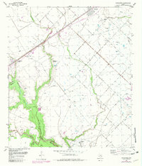
1953 Map of Kendleton
USGS Topo · Published 1981About this map
The San Bernard River serves as the prominent boundary between Fort Bend Co and Wharton Co, anchoring a landscape defined by meandering waterways and agricultural development. The settlement of Kendleton sits along the Southern Pacific railroad, characterized by its historical proximity to Blossom Prairie and the smaller enclave of Peach Break. A significant cultural landmark is the Historical Marker (Site of Mexican Army Encampment) located near Turkey Creek, offering a direct link to the region's military history.
Find a feature on this map
23 named features on this map. Tap any name to fly to it.
Don’t see what you’re looking for? This feature index may not catch every label — zoom into the map to look around manually.
Map Details
Editions of this 1953 Kendleton Map
2 editions found
Other maps of this area

1950 · Houston
USGS Topo · 1:250,000

1953 · Needville
USGS Topo · 1:24,000

1953 · Guy
USGS Topo · 1:24,000

1953 · Kendleton
USGS Topo · 1:24,000

1953 · Wharton
USGS Topo · 1:24,000

1953 · Hungerford
USGS Topo · 1:24,000

1953 · Boling
USGS Topo · 1:24,000

1953 · Seguin
USGS Topo · 1:250,000

1955 · Richmond
USGS Topo · 1:62,500

1956 · Wallis
USGS Topo · 1:62,500