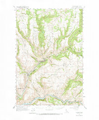
1961 Map of Kendrick
USGS Topo · Published 1973About this map
The Potlatch River winds through deep canyons and high plateaus in this mid-century portrait of northern Idaho. Concentrated along the river valley, the towns of Kendrick and Juliaetta serve as the primary hubs for the surrounding agricultural uplands. The Northern Pacific railroad follows the river's course, highlighting the vital transportation corridor that connected these isolated settlements to the larger regional economy. To the south, the landscape shifts toward the Clearwater River, where smaller riverside locales like Agatha and Lenore sit beneath the high elevations of Amos Bench and Camas Prairie.
Find a feature on this map
54 named features on this map. Tap any name to fly to it.
Don’t see what you’re looking for? This feature index may not catch every label — zoom into the map to look around manually.
Map Details
Editions of this 1961 Kendrick Map
2 editions found

Other maps of this area

1924 · Kamiah
USGS Topo · 1:125,000

1955 · Pullman
USGS Topo · 1:250,000

1958 · Pullman
USGS Topo · 1:250,000

1958 · Lapwai
USGS Topo · 1:24,000

1958 · Lewiston Orchards
USGS Topo · 1:62,500

1958 · Culdesac
USGS Topo · 1:62,500

1960 · Troy
USGS Topo · 1:24,000

1960 · Moscow Mtn
USGS Topo · 1:24,000

1960 · Potlatch
USGS Topo · 1:62,500

1961 · Deary
USGS Topo · 1:62,500